ActiveG InformME
Mobile GIS for Maximo and Mobile Informer
Give your mobile workforce real GIS
Built upon Interloc Solutions’ award-winning Mobile Informer platform for IBM Maximo, ActiveG InformME provides a full GIS experience for your mobile workforce. Whether you have internet connectivity or not, your users will have robust Maximo work management capabilities coupled with a rich, online/offline spatial data interface.
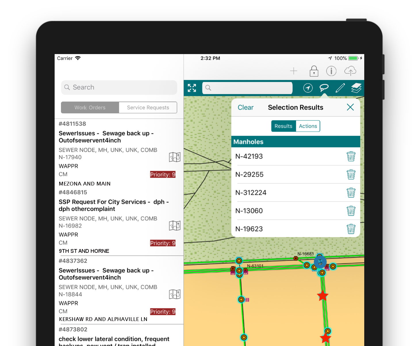
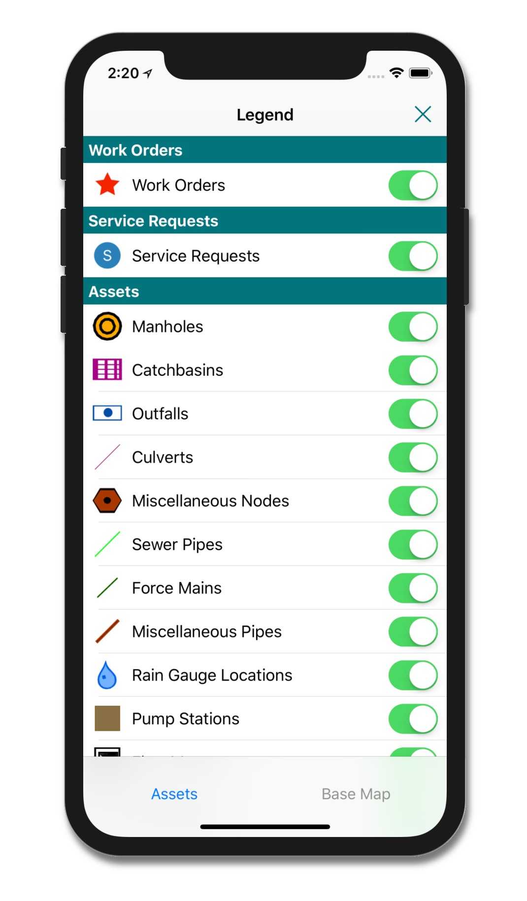
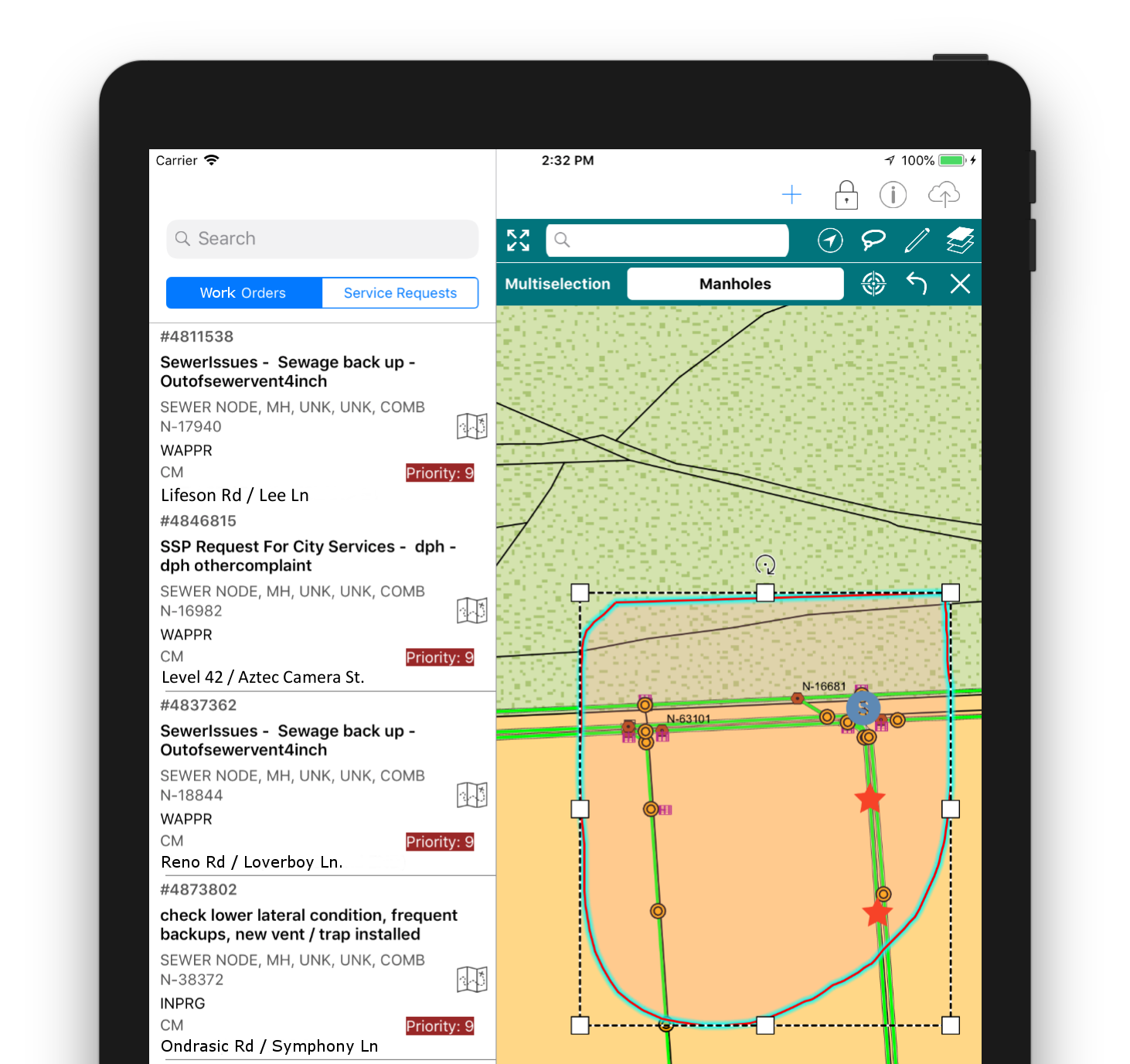
InformME users not only have complete map visualization of Maximo work orders and service requests, they have complete access to all the information your Esri ArcGIS Server can provide. So even if you’re running InformME in remote locations, you’ll still have all the mapping information you need to make good decisions.
Here are just a few of the outstanding features:
- Easy work order location
- Redlining
- Attach multiple assets to work orders
- Search GIS records
- Unobtrusive synchronization of GIS offline data (your users will hardly notice)
Why is it called InformME?
InformME is the blending of Interloc Solutions‘ Mobile Informer technology and ActiveG MapEngine, the premier spatial integration for Maximo. So Informer (Inform) + MapEngine (ME) = InformME—the power-packed, award-winning combination of mobile mapping and Maximo processing.
System Requirements
InformME needs the following system environment to provide your team with the best mapping experience:
IBM Maximo 7.5 or greater
Esri ArcGIS Server 10.4 or greater
iOS 10 or greater (Android coming soon)