Discover easy spatial solutions from ActiveG
ActiveG provides innovative, advanced spatial software solutions for companies running IBM Maximo, delivering complete integration of your Enterprise Geographic Information System (GIS) and Enterprise Asset Management (EAM) systems, via its MapEngine™, PowerSync™, and Nash Workflows™ solutions that streamline your Maximo experience.

ActiveG and Esri
We specialize in making apps better with Esri ArcGIS technologies.
As a proud member of the Esri Partner Network, ActiveG specializes in helping you maximize your investment in ArcGIS by integrating it with other business applications.
Our ArcGIS-based solutions are used worldwide by multiple industries, including water distribution, sewer collection, electrical transmission and distribution, gas and oil transmission/distribution, public works infrastructure, and transportation infrastructure.
Spatial Data Services
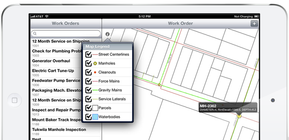
An often overlooked part of major Maximo projects is the GIS data synchronization to support 1) spatial integration with Maximo, and 2) asset/location creation/updates in Maximo.
Many companies start off their projects without the spatial integration as part of a phase 1, and they plan on “easing into it” later. However, if your company is planning on GIS integration at any point in the future, addressing the relationship between your GIS data and your Maximo asset data is a critical step to take early in your Maximo project.