
The City of San Marcos, Texas is nestled between Austin and San Antonio in the Texas Hill Country. Between 2010 and 2022, the city experienced over 50% growth. With a 2023 population estimated at over 68,000, the city’s public works staff has plenty to do to keep up with the expansion. One way the city’s staff is successfully managing the growth is to innovate and automate its utility maintenance activities with ArcGIS.
As a GIS analyst for the City’s Public Works department, Gene Sipes is helping to push this innovation using ArcGIS Field Maps with ActiveG Nash Workflows to simplify the way maintenance crews track and report critical stormwater inspections that help keep City infrastructure ready and prepared for storm events.
Using Field Maps on mobile phones, stormwater crews canvas a neighborhood performing inspections on storm manholes, inlets, outfalls, and channels. All the stormwater assets are presented as features in Field Maps. These stormwater features are all linked to a related table for inspections. The inspector selects the asset they are inspecting on the map, and then adds an inspection record, answering a series of relevant questions as a part of the inspection.
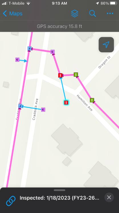
Field Maps display of stormwater inspections
Stormwater inspection map in ArcGIS Field Maps used by the City of San Marcos, TX.

Field Maps stormwater inspection form
Stormwater inspection form data in Field Maps drives downstream actions in Maximo.
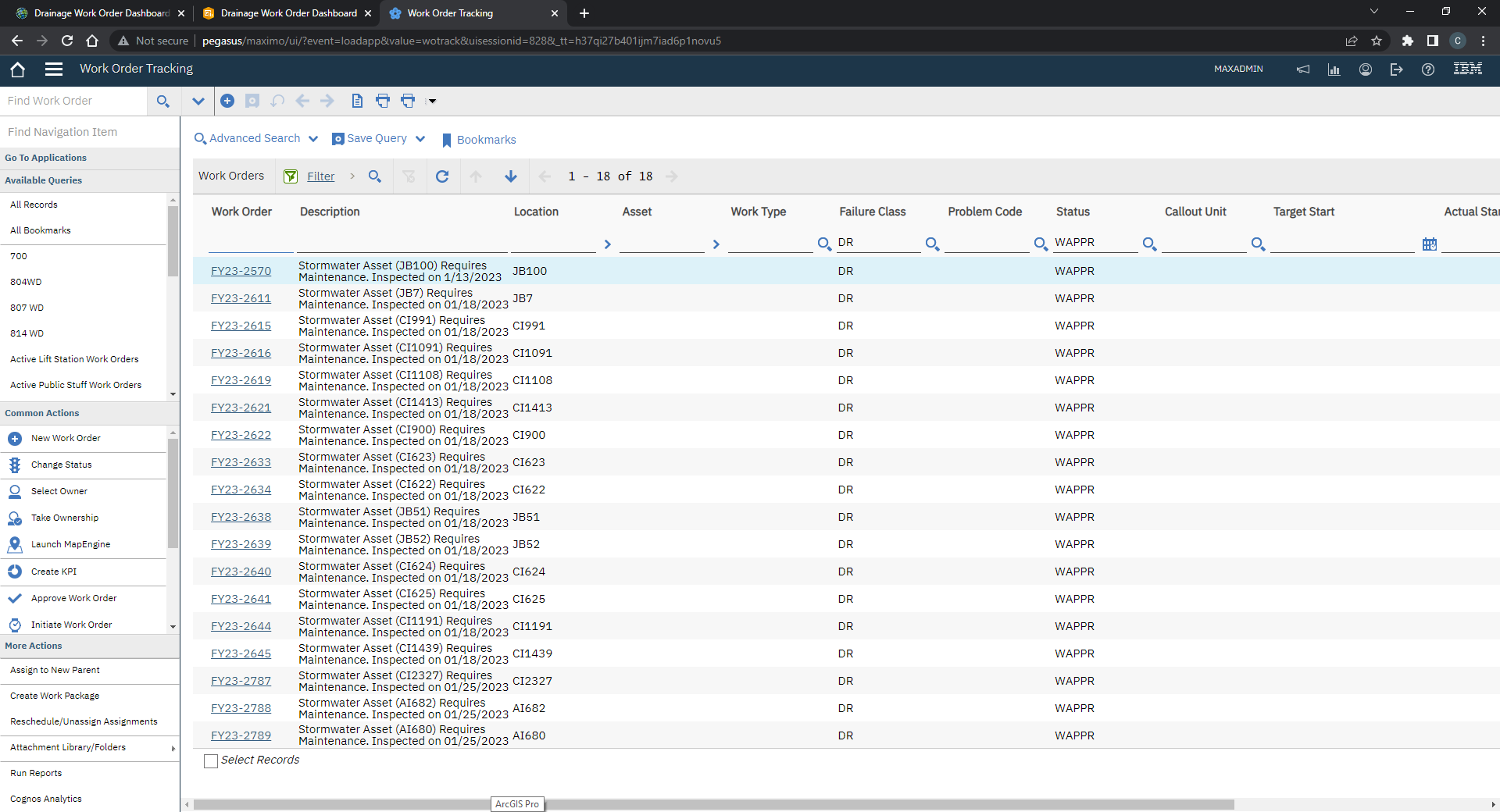
Nash-generated Maximo Work Orders
These Maximo work orders were created automatically by ActiveG Nash Workflows, based on inpection results from ArcGIS Fieldmaps.
To integrate these activities back into the City’s asset management system (IBM Maximo), Gene created an integration workflow using ActiveG Nash Workflows, a no-code, automation engine for ArcGIS. If the inspection survey question “Requires Maintenance?” is set to “Yes” and submitted from the field inspector, Nash Workflows detects these changes and generates a work order in Maximo with prepopulated fields. Nash then writes this work order information back to the inspection record for the inspector to reference.
When the inspector comes back to the office, they can review their Maximo work orders which were created automatically and then schedule their work or any required materials or tools.
Drainage and stormwater work and inspections are then tracked in a dashboard for ArcGIS, shown below. Work order data from Maximo is integrated into the ArcGIS dashboard using Nash Workflows, as well.

To make this process as seamless and easy as possible for the field inspectors, Gene stood up his ArcGIS feature service such that his users can log in on either City-managed devices or their personal mobile devices, while still ensuring security of the City’s data. Using SAML, user credentials are stored with the feature service behind the City’s firewall. This feature service is then stored as an item in ArcGIS Online, with an option to pass in credentials. So, when users log in to Field Maps with their city account, their permissions are validated through the firewall, allowing usage of personal phones or iPads.
Gene says, “The field crews really like the simplicity of the form in Field Maps, and they really like not having to worry about manually generating work orders for those exceptions. Nash takes all that pain away.”
Recent Comments